
 Deutsch
 Español
 Français
 Italiano
 Nederlands
 English
Sale!
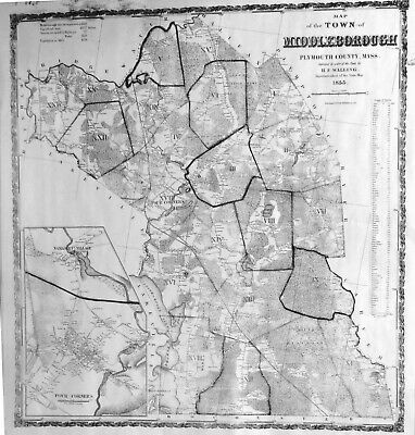
1855 Middleborough, MA Map by H. F. Walling – Home Owners Names Forests Schools
$13.19
100
Description
For sale is this black and white reprint of the 1855
Middleborough Map made by H. F. Walling, Superintendent of State Map. The original map was shaded in different colors for each district (Identified with heavy border and Roman Numerals.)
The map shows
ponds, railroads, schools, roads, swamps, cemeteries, churches, mills present
165 years ago in 1855.
Buildings are shown with a
black square, and homes are identified with the surname and first initial of
the homeowner.
Town data is
show in the upper left corner on the map and town streets are listed on the
right with their length in rods.
Detailed
maps of Nemasket Village and Four Corners are in the lower left corner.
This map measures 23 inches by 24.5
inches.